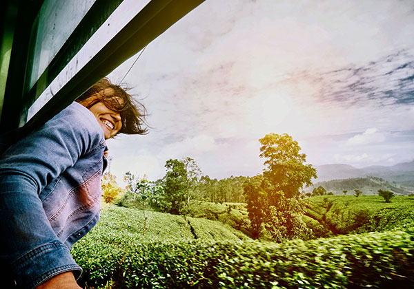

Horton Plains, a major biodiversity hotspot which has an endless collection of 750 species of plants, 24 species of animals, 87 bird species, stunning trees and has flat terrains with slight inclines and declines which make trekking an exciting adventure for each and everyone.
Trekking through Horton Plains takes you through changing vegetations and landscapes, encountering stunning landmarks of which the key attraction is ‘World’s End’ which is a sheer drop of 880 metres giving breathtaking views of unfolding landscapes beneath your feet, stretching all the way to the southern coast of the island; Bakers Falls, a beautiful waterfall that would make you feel relaxed; Mini World’s End which is a smaller version of the main attraction; Kirigalpoththa mountain, the second highest mountain of Sri Lanka and Thotupola Kanda, the third highest mountain; all of which give great exploration of this magnificent world heritage site of nature.
The best times to visit Horton Plains are from January to March and from July to September. There are three trekking trails to experience all of Horton Plains’ beauty.
Trek to World’s End:
The 9 kilometre circular trek to World’s end would take you on a journey wandering through mist capped grasslands, evergreen forest patches and cloud forests with streams and pools along the way, all of which you would hear chirping of birds, sounds of gushing water and wind breezing past you, making for a serene and charming experience.
The trail takes approximately 3 hours to complete and it is ideal and recommended to start early morning preferably around 6 am to reach the cliff before 9 am since clouds of mist will start rolling in and you would not be able to see anything. You do not need any special gear except for a comfortable pair of shoes, a light jacket and of course plenty of drinking water.
The trek starts at the visitors’ centre where you have to climb down a few steps and walk along a path for about 500 metres reaching a fork like junction. You can either take left or right turn since both paths form a loop, therefore, either direction would lead you to Worlds end and back to the same starting point.
However if you choose to turn right, you will trek through the plain descending down towards a small stream which is one of the tributaries of the Belihul Oya. Continue walking and keep to your left and you would come across a small pool known as Chimney pool; continue past it and you will see an L shaped pool known as ‘Leg of mutton pool’. Keep walking along and you will enter a forest patch, where the trek gets rather challenging but fun with many steep climbs and descends reaching Baker’s Falls. You can walk along the foot path leading to the observation deck in which you could go down to the base of the fall if you wish and get back up to continue the trail. The trail through the forest leads to another plain that continues towards the escarpment at World’s End.
Once you leave world’s end, you would proceed along a narrow path through a forest for about a kilometre reaching the edge of the plateau which is Mini World’s End, where again you would see stunning views of the surrounding landscapes. From this point, your trail would be through the forest and a wide dirt path leading you to a plain that would continue till you reach the junction where you had started.
Kirigalpoththa Nature Trail:
Kirigalpoththa Mountain is the second highest peak of Sri Lanka after Pidurutalagala Mountain. The moderate nature trail up to the summit is really beautiful and takes you through grasslands, cloud forests, and scrublands where you would encounter all of Horton Plains’ exotic species of flora and fauna.
The trail of 7 kilometres begins through the valley that starts from behind the visitor centre and continues for approximately 500 metres through the valley and slowly ascends a moderate climb towards a scrub covered hilly area and continues further towards a patch of forest and then an open plain which descends towards a small stream.
Cross the stream and then enter a forest area again where you would continue walking for about 300 metres till you reach a much larger stream. After crossing the stream, the trail would lead upwards and to the right where you would find a thick forest on the left and grassland on the right which looks unique since it is covered with bamboo trees and you will come across many natural springs and flowers that add beauty to the place.
The trail continues through cloud forests, streams and you would walk through an area of nelu flowers which bloom during the month of April. Thereafter you will trek though a fairly flat plain till you come to a steep climb to the base of the Kirigalpoththa mountain and then climb to the summit. As you climb, the vegetation morphs into a scrubland rather than the thick cloud forest and continue climbing till you reach a rocky slab which marks up to the summit and provides stunning views of the surroundings. To reach the summit, you have to navigate along the edge of the mossy slab and then cross a small area of forest at the top.
The entire trail takes roughly 4-5 hours depending on weather conditions and fitness of each individual. Since the trail goes through forests with undergrowth, it is better to wear long trousers that cover your legs to avoid any scratches and also the temperatures can get quite cold so its recommended to bring a jacket or sweater to keep you warm and comfortable.
Thotupola Kanda Nature Trail:
Thotupola Kanda or Mountain is the third highest peak of Sri Lanka. The trek to the summit is very easy since it takes only an hour and is a little over 1 kilometre long. The nature trail allows you to explore the montane forest of Horton Plains and once you are at the summit, you will get wonderful views of the savannah grasslands and cloud forest areas of the plains.
The trail head begins at the Pattipola entrance of Horton Plains which is located on the Pattipola-Ohiya road. Climb a few steps from the road to enter into the trail which will continue on a rather flat surface for about 150 metres and then goes through a thick forest with very dense underbrush. After about 200 metres along the trail, you will slowly start to climb, and then it will resume flat and then descends to a point where the path makes a right hand angle degree to the right towards a fair climb where the large trees will disappear and the vegetation changes into bushes and scrubs towards a small peak. From this small peak, the trail goes down into a forest area and then into a flat plain. Once you have completed about 1 kilometre from the trail head which will be on an open plain, you will start to climb a steep slope for about 250 metres then you will reach an open area till you reach the main peak where you would see a transmission antenna at the summit.
Please note that there are no sources of any water along this trail so please make sure you carry plenty of water. Also since there is very dense undergrowth in the forest areas, it’s not advisable to wear shorts.